The DMZ or De Militarized Zone was setup by the Geneva Accord for the division of North and South Vietnam. It runs West to East along the Ben Hai River from Loas to an Island controlled by the North Vietnamese (Co Island). It was nominally described as running along the 17th parallel but it is really south of that for most of it (the mouth of the river is at the 17th parallel). It's about 100kms north of Hue.
 |
| I'd smile every time I'd see this sign (and there were hundreds of them). Turns out they are advertising for a brand of paint! |
As you will remember if you've been following all my blog entries, during the first IndoChina War, the French lost control of Northern Vietnam to Ho Chi Minh's Viet Minh and this was setup as the border in 1954. Southern Vietnam (later the Republic of Vietnam) was setup under Emperor Boa Dia.
 |
| North Vietnam rice paddies... if you look at some of the war photos, these very fields had more bomb craters in them than you could count. Not that you'd know it today! |
The area within 5 kilometers on either side of the border was declared to be a demilartized zone and troops from both sides were banned. Canada, India and Poland (non-communist, communist and non-aligned respectively) constituted the International Control Commission which was supposed to monitor the 1954 Cease Fire agreement. It wasn't particulary successful (understatement of the year) as all sides often spied for the others and several members of the ICC were killed.
 |
| This is the meeting place for the ICC delegation... |
 |
| Complete with plaster casts of them meeting! The Canadian is in the blue shirt. |
 |
| The (new) bridge over the Han River which marks the DMZ. |
 |
| The old foot bridge (the span had been knocked down countless times and put back up before it was replaced after the area was turned over to the NVA by the real bridge along side... note the South V| Vietnamese gate on the other side. |
 |
| A monument to the troops lost on the battlefields. It is also supposed to symbolize the South Vietnamese looking longingly over the blockaded bridge to their friends and family in the north to come liberate them. (The sad reality is that it was the other way around - at least at the beginning of the war). |
We stopped at the bridge on the North side of the Ben Hai River and toured the observation shack/conference shack that was used for the ICC team. We couldn't help but notice the large speaker arrays that were deployed towards the south and the huge Vietnamese flag. From the museum at the site, we were able to determine that both sides ran a war of watts on the speaker systems trying to drown out the other with propoganda. They had samples of the large speaker cones from both sides and at one point they were up to 15000 watts and had to beef up the incoming power to support it. Every speaker we saw was full of bullet holes so it was obvious the other side also used clandestine methods to try to stop the sound! They also had a race on who could build the highest flag pole. They'd even send teams over to the other side to knock down the otherside's pole (such teams usually getting killed in the process).
 |
| Only the flag on the North side remains standing (for obvious reasons) |
 |
| North Vietnamese speaker array (one of dozens) |
 |
| One such speaker to give you some perspective |
 |
| Note the bullet holes and bomb damage |
One of the other interesting stories was that the dividing line was painted white on the bridge. The south would paint a green line on their side to show it was South Vietnam and the North would paint a green line on their side to show there was no difference. They'd change the colour to red, and the North would follow immediately. Both sides kept lots of paint on hand until they finally gave up many years later and started firing bullets for real.
Before we got to the bridge, we had also toured the Vinh Moc Tunnels the largest remaining tunnel system in Vietnam. They built over 245 Kms of tunnels and this is where they sheltered from the bombardment and artillery. The story was that it was the common villagers in Vinh Moc who stayed there but they let it be known that everyone who was there (man/woman/child) were also VC and at night would supply Co island or the south. There were bomb craters all over the place but nobody was ever killed there as the tunnels were too deep (15-36 metres) and in sandstone. At the height, they had a picture of the DMZ area on both sides of the river completely pock-marked by bomb craters (they say from B-52 bombers) but the US was never able to stop the 300 VC at Vinh Moc from carrying out guerilla tactics. The VC had setup similar systems in other villages and it was in part this frustration with local villagers supporting the VC that triggered the Mai Li massacre where a US Infantry Troop killed over 300 women and children (only one man, Lt. Calley, was ever convicted).
The tunnels had "rooms" for the families that were in essence a 5x10' open branch of the tunnel. There were 17 babies born in those tunnels (16 of which are still alive and living in the town of Vinh Moc today) so I guess they didn't get too squemish about privacy! They had a long wide(r) hall that they would hold propoganda meetings in and a birthing room. With only 300 people there, I don't know why the US didn't just invade the place and clean it out but they never did.
 |
| This was room for one family... they had room for 300 people like this. |
 |
| This was the big meeting room used for propoganda meetings |
 |
| The caves also opened out to the cliff side... you could see why it was so hard for the US to bomb. The tunnels were 15-25 metres below the summit of the cliff. |
 |
| Here's what they were guarding |
 |
| There were bomb craters like this all over but not one person lost their life due to a cave in or bomb according to our guide |
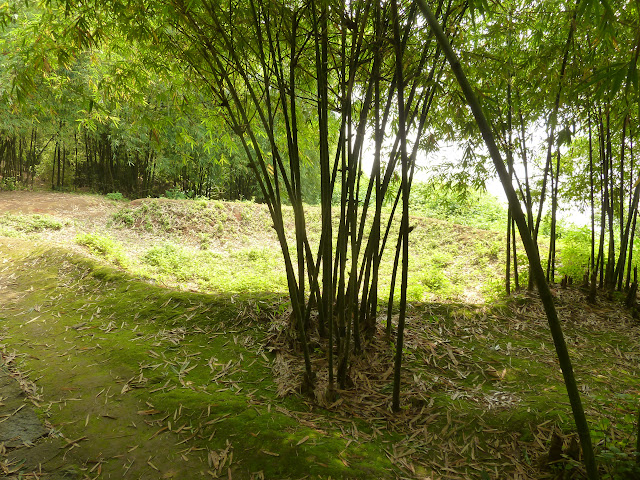 |
| Another one to give some perspective... this one above the roof of the cave entrance you saw above. It obviously didn't make much of a difference. |
After Vinh Moc, we travelled to a cematery filled with unknown soldiers (one of many we saw on the trip). The one thing that struck us most driving out from Hue to Phong Nha was how many cemateries there were... almost an unending line of them. I would have loved to ask how many of those bodies came from the war but I couldn't make our driver understand the question.
 |
| The War Cemetery |
 |
| One of eight of such subplots within it. |
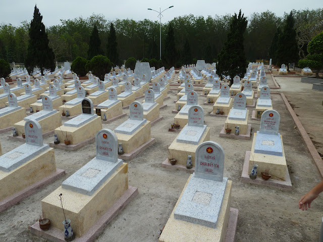 |
| Still well cared for. Our guide said both US and Vietnamese soldiers but I believe the US soldiers were all repatriated home during the armistice. |
 |
| The captions all say... here lies an unknown soldier... on 95% of them. |
Then we turned 90 degrees and headed west along Highway 9 which was the defensive perimeter that the US tried (unsuccessfully) to keep the NVA and VC from crossing. There are lots of "firebases" along there and we saw the relics of Con Tien which was really just a Vietnamese memorial statue for the soldiers that lost their lives there. It was built on a large escarpment overlooking the river.
 |
| The hill containing the firebase of Con Tien in the distance (we had just crossed the bridge going south into what was the Republic of Vietnam) |
 |
| They have built a large monument on the firebase now. |
 |
| The North troops marching south |
 |
| Wreckage of a tank by the roadside |
From there, we passed the Rockpile, another large hill that could only be summited by helicopter that was used as a lookout and then on to Khe Sanh, the site of the heaviest fighting of the war and probably the most significant battle. All along up until January of 1968, the story from Lyndon Johnson, his secretary of defence Macnamara (the Ford CEO who thought he could run the war like an assembly line) and General Westmoreland who was in charge of the whole theatre was that they were slowly beating apart the NVA and VC to the point they couldn't launch major offensives anymore. They weren't trying to take over the North but contain them from entering the south and try to get them to the negotiating table. Westmoreland even won a Time person of the year award for his prosecution of the war up to that point.
 |
| The Rockpile - a US Marine Observation post... but just what they could see in that jungle from up there was beyond me. |
 |
| You could not see 10 feet into the jungle |
 |
| A Vietnamese flag is up there now. |
 |
| That line of hills and the valley between them is the Han River Valley which is the route of the Highway 9 corridor the US was trying to use as a barricade to stop the North from crossing. The flat ground was all jungle. |
When the VC/NVA launched the Tet Offensive, they also (just prior to that) launched an assault on Khe Sanh which was a major base used by the US to stop the flow of materials down the Ho Chi Minh trail. It was especially important since it was next door to Laos (where the NVA was running war materials around the Highway 9 blockade and back into South Vietnam). This was one of the most heavily fortified bases the US had and they had indicated that they would hold it at all costs. They were quite surprised when despite all the electronic listening gear installed in the jungle around the base, they missed 200,000 NVA and VC massing for the attack. There were many battles around the base and most of it was evacuated but at one point the weather socked in and the marines were left to defend themselves down to the last man.
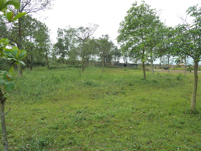 |
| The Khe San perimeter... pretty hard to defend! |
 |
| The wreckage of an A-37 (like the one in Hue) attack plane |
 |
| A US Bunker |
 |
| Note the mortar tubes in the ground (for launching mortar rockets at the enemy) |
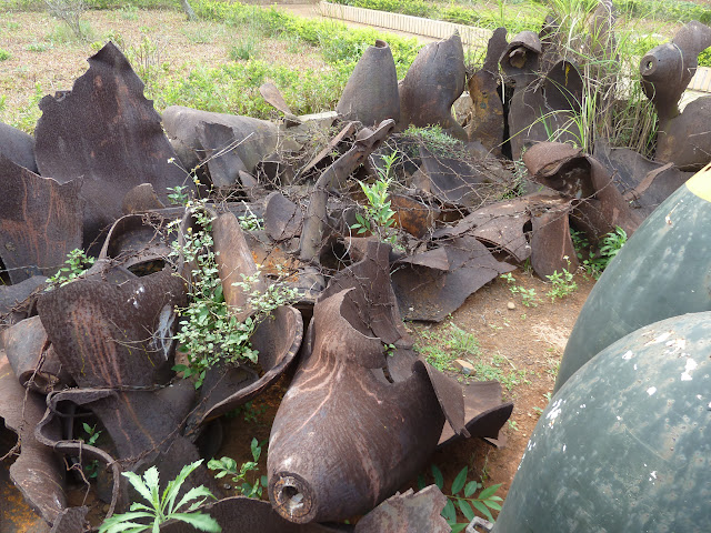 |
| Some of the exploded ordanance dropped on the place (with the US troops still in place) |
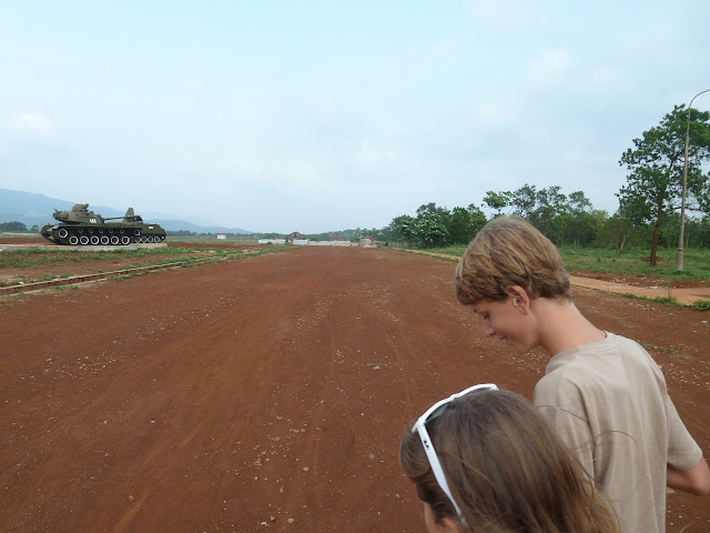 |
| The runway at Khe Sanh |
 |
| The field in behind the tanks are where the barracks and the actual camp was |
 |
| They even captured a Hercules |
 |
| And a Chinook |
 |
| Bomb crater |
 |
| Right up against the bunker... that was a close one! |
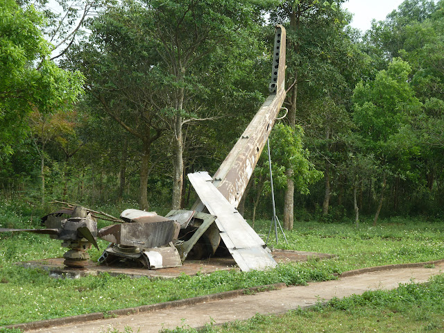 |
| These guys did not make it |
 |
| A captured Huey and the museum in the background |
The VC/NVA were beat back at a cost of 10 soldiers on the North side to 1 on the South/US side so it was a huge failure for the VC but politically, the fact that the NVA/VC were able to launch such an offensive after the US had so publically assured everyone the war was in the mopping up phase, dramatically shifted public opinion against the war and the US abandoned its strategy of trying to contain the VC/NVA north of Highway 9. The VC/NVA never did manage to overrun the base, but soon after Westmoreland pulled out all the US troops and abandoned the base - much to the resentment and horror of his troops who had sacrificed so much to hang on to the place. This was a story that was to repeat itself over and over. The US had instituted a draft and most of the combat platoons were fresh from the States and served one tour of 12 months and then the experience was lost for ever as they headed back to the States. Many of the battles fought by these troops were later squandered and troop morale plumeted.
The museum at Khe Sanh again was filled with the North Vietnamese perspective (obviously) but it was also clear that they had lots of help from locals in the south who were just trying to get the westerners out of their country. One of the biggest lessons, I walked away with here was that the US entered this war with no clue as to what the local population really wanted and prosecuted it with people that were in many cases corrupt and only in it for themselves. When you have a large chunk of the local population against you, you aren't going to win - pretty much what's happening in Afganistan these days. As much as people hated the communists and the atrocities they inflicted, they were on the side of reuniting Vietnam while the US was just trying to contain the North Vietnamese to above the 19th parallel. It was a real tragedy that 58,000 US soldiers (including 3000 from Canada who had volunteered and joined the US armed forces) and more than 4 million Vietnamese on both sides had to die - and from our impression, things aren't much different in Vietnam these days from elsewhere in South East Asia (Thailand in particular).


 |
| A photograph during the battle. I left this one full size so you could study the detail |
 |
| One of the woven packs the NVA and VC used to carry shells down the Ho Chi Minh Trail. |
 |
| US uniforms.... with name badges still on them. |
The Vietnamese certainly don't hold a grudge at least. They seem happy they have their country, and they've embraced capitalism with huge enthusiasm. After our sobbering trip through the DMZ, we drove back to Hue to catch the night train ("soft" sleepers this time!) to Ninh Binh so we could visit the tunnels and karsts around Tam Coc.


No comments:
Post a Comment